Monday, April 12, 2021

St Clears to Saundersfoot on Wales Coast Path: Day 14

Laugharne and reaching Pembrokeshire were the highlights today. 

Not wishing to miss my train home today from Saundersfoot I left St Clears early, in grey drizzle a little after 7 am, clutching a coffee and cookie from the Starbucks by my hotel. Much of today's route was beside two lane, moderately busy roads, but it had been made safer by running the Coast Path through fields, on just the other side of the hedge to the road, maybe not too scenic but it avoided the need to dodge fast cars and lorries. More substantial deviations of the Coast Path from the road took me through muddy fields, water collecting in the hoof prints left by sheep and cattle, and occasional woods. Such paths led me down through poor pasture and clumps of reeds closer to the river, which seemed to be flooding flat grassland beyond its banks.

These paths contrasted with the well maintained trail into the village of Laugharne which ran through woodland, contouring steeply sloping hillside beside the River Taf. This morning's high tide had transformed the river; the sandbanks and meandering channels I saw yesterday had metamorphosed into a large, unbroken expanse of water. Trees, moss and ferns clothed my surroundings in green. Ruins of stone buildings beside the path were so covered with moss and verdant vegetation that I barely noticed them as I walked by.
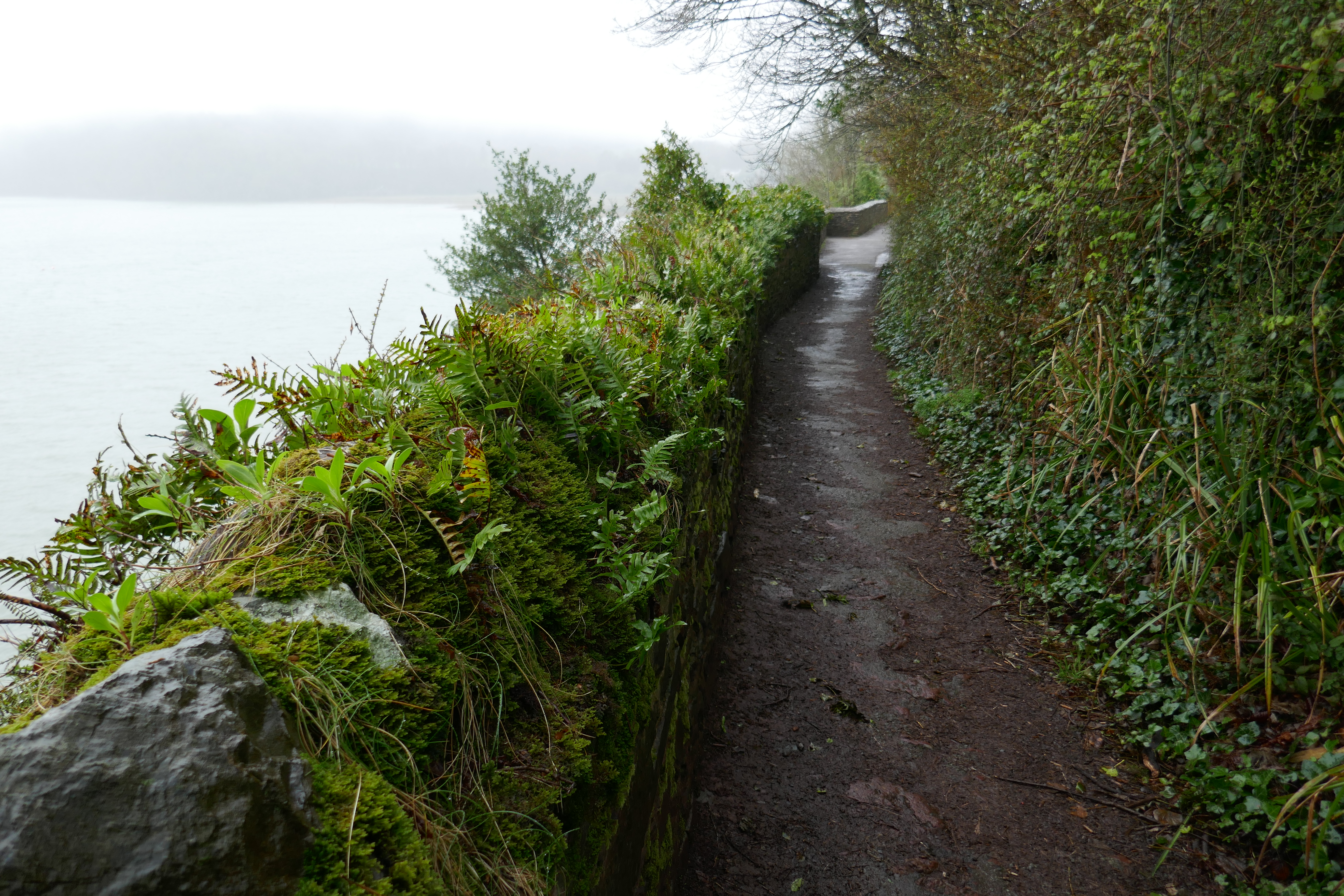
Path into Laugharne

Laugharne (pronounced "Larn" with a long "a") is famous as a place where the poet Dylan Thomas lived. My path went by the shed he wrote in, overlooking the river and sea. Versus from his "Birthday Poem" are printed on noticeboards spread along the trail into and out of the village. When I last hiked this section I stayed the night in Laugharne, visiting the grave of Dylan and his wife, answering questions for a lady conducting a survey on the Wales Coast Path and enjoying an afternoon of folk songs with a few beers at Brown's Hotel. Had it not been closed I would have visited the Norman Castle which stands dark with a sense of foreboding at the edge of the village, overlooking the channels and salt marsh of the estuary with its bobbing boats. 

View from path out of Laugharne

Climbing out of Laugharne I wondered if the trees I was passing through were part of "Milkwood" from Dylan Thomas' famous radio play, as the place he called "Llaregubb" (try reading it backwards) may have been partly based on Laugharne. After curving over the top of the old sea cliffs, now tree covered, the path continues along their base for many kilometres. The sea has long since receded into the grey distance, beyond the green, channelled plain populated by sheep and beyond, extensive dunes invisible to me in the mist. Much of this is used by the military as a firing range and test facility, so the Coast Path is forced inland, and closely follows the road as it crosses adjacent fields to reach the village of Pendine, where there is access to the beach. On this long area of sand several land speed records were achieved in the 1920's, most notably by Sir Malcolm Campbell in Bluebird, but the vehicle in the Museum of Speed at Pendine is Babs, driven and crashed by J. G. Parry-Thomas, who died in his last, fatal attempt at the record. When I was a child you could take your own car onto the beach, and one exciting day, as we were off the public highway, my father let me drive our old grey Austin, sitting on his knee. My early attempt at the wheel failed when I stalled the car while attempting to change into second gear, my further manipulating the gear stick while I attempted clutch control. On another visit our neighbours' car became stuck in wet sand, as the sea was some way out they had driven down closer to it which proved unwise. We tried to tow him out with our car which, inevitably, also became stuck. Much effort was needed to move both cars before they were engulfed by the rising tide. I had visions of them floating out to sea.

After two and half days of walking through farmland, well away from the sea as the trail worked its way around the various estuaries, the section from Pendine to Saundersfoot was a classic coastal stretch. Open sea was to my left as I walked up and down paths through yellow gorse on the steeply sloping coastline cut by valleys. Little mercy was given to the tired walker with steep climbs, occasionally aided by rough steps. Wet mud on downward sections inevitably resulted in me ignominiously sliding onto my backside. No damage except for heavily mudded clothing and my transition to a grumpy old man. By a little stream I attempted to wash off the worst of the mud, but for the rest of the day I looked pretty disreputable.

Start (or finish) of Pembrokeshire Coast Path National Trail.

At Amroth a milestone! I left Carmarthenshire and entered the county of Pembrokeshire, the Pembrokeshire Coast Path began, marked by white acorns, indicating it was a National Trail, as well as part of the Wales Coast Path (also a National Trail, but a Welsh one rather than a British one)! For today there was still one more hill to climb over which took me  down into Wiseman's Bridge. From there the trail follows the bed of an old railway line to Saundersfoot, including a few tunnels, exciting for children. One was long enough for the darkness to hide the people walking towards me. Managing to avoid any collisions, I reached the popular, seaside town of Saundersfoot with its beach and cafés and holiday apartments. It was then a further two kilometres to reach its railway station.

The train home passed many of the places I had walked through, running alongside the waters of the Towey and Lougher. High tide brought the water up to the edge of the line, engulfing the beach I had sat beside at Ferryside. The small channels between acres of sand had been transformed into a great lake beside my swiftly moving carriage. 

Saundersfoot


Sunday, April 11, 2021

Carmarthen to St Clears on Wales Coast Path: Day 13

A day of drizzle as I walked through farmland along lanes and paths.

Leaving my hotel I admired the gate house of the old Norman Castle as I wandered down to the river joining the Coast Path by a rather dirty cable stay pedestrian bridge. Nearby was a wire mesh enclosure containing coracles, traditional boats used to fish in this area. Small, oval, single person craft, they were originally made of hide, stretched over a willow frame, but fibreglass was evident in some of the examples in front of me.

After some playful "sculptures" beside the road the path continued by the river, passing under a railway bridge. The gear wheels on its side, now locked with grey paint, showed that at one time a section of the bridge could be lifted to allow the passage of taller ships. A sign perhaps that Carmarthen was once an important port, before the arrival of the railway, when shipping goods by sea was considerably easier than transporting them overland. A subsequent road section was not to my liking, passing cars forcing me into the rather limited verge for safety. Following was a much preferable walk through Green Castle Woods on a path among wild garlic and white anemones where the ground sloped away to the river. 

Typical Carmarthenshire single lane road followed by the Wales Coast Path

Much of the rest of the day was on lanes and paths across lush green pasture in drizzle which obscured the views. The environs of Llansteffan was the most attractive period. Leading into the village was a well maintained path with verges or hedges each side. Then the route took me down to the long, sandy beach. With the tide out the area of sand was massive, although I would not want to stray too far out for fear of being caught by an incoming tide. Instead I repaired to the tea shop at the end of the beach for a takeaway latte and iced cherry cake. After I bought it I wondered if a toasted tea cake would have been better, dripping with butter, then I noticed a stall selling pies, maybe one of those, rich with gravy, would have been even more gorgeous. Irritated by my lack of appreciation for getting anything I sat on a bench in the light rain, overlooking the beach and ate my cake, coffee and a sandwich I had bought last night, while watching people on the beach, well wrapped up against the blustery, wet weather. Having gained a cherry red face from the sun yesterday, I had applied plenty of sun cream this morning, but the effort was clearly misplaced.

Welcome tea shop in Llansteffan.

Primroses on the path out of Llansteffan

Climbing up from the beach the path took me under the ruins of yet another Norman Castle before plunging into woodland on a track lined with primroses or celandine. On an earlier hikes I was astonished by the scale of the sandbanks and interweaving channels of the estuary, but today the views through gaps in the vegetation were disappointing, obscured by the grey, wet mist. As the path rounded a second headland I could just about see the end of Pendine sands, and later, the village of Laugharne which I will visit tomorrow.

As I now headed up the valley of the River Taf, the route wandered up and down hills, and along a muddy section of flood plain. The quiet lanes and green fields were not that exciting as I pushed on with my head down against the weather. At around 5:30 pm, eight hours after I began I arrived at the outskirts of St Clears. While the village is not directly on the coast path I diverted into it for my accommodation for the night. Only an earth mound remains of St Clears' Norman Castle, and the river looked too small for the shipping which was said to have once used it, but it was the scene of the Rebecca riots in the 1840s. These events caught my imagination in my youth. Railing against high tolls for using the roads, men dressed as women (I assume as a disguise) attacked the toll booths.


Saturday, April 10, 2021

Pembrey to Carmarthen on Wales Coast Path: Day 12

Despite wading through knee deep water early on, a pleasant day walking through farmland and the villages of Kidwelly and Ferryside.

As the rays of the rising sun penetrated the tall pine trees I packed up my tent and left the soft, mossy ground of the hollow in which I spent the night. Deciding to revisit the beach now the wind had dropped from yesterday, I followed forest tracks heading towards the sea. Despite the trees being planted on sand, water had collected on low points of the track. Thick undergrowth prevented me from going directly to the sea so I diverted on a track heading west, parallel to the sea hoping to find a path through the brambles and fallen branches. The track became increasingly submerged below stretches of water. Initially I worked my way around them, but the dense vegetation and the extent of the water made this progressively more difficult. Inevitably the water came over my boots, soaking my feet, so I simply waded through the knee deep water to reach the concrete track of the Wales Coast path where it connected to the beach. Sitting on a rock on the beach I emptied my boots of water and wrung out my socks. Not a good start to the day. On my previous hike along this section I had walked the length of the beach, rather than diverting into the trees, passing an old wreck, the bare bones of a wooden ship. It was low tide with the sea a long, long way out, I could see in the distance what I took to be cockle pickers beside some vehicle at the sea's edge.

Sunrise from my campsite through the pine trees of Pembrey Forest

Pools of water submerging tracks through Pembrey Forest

Pembrey Sands

Nevertheless the sun was shining as I left Pembrey Forest, passing two joggers coming the other way. One warned me of cows on the track, and indeed as I crossed flat grassland I began accumulating a herd of cows. I left them at a gate and continued by brick pill boxes from the Second World War, no doubt guarding the nearby air field, to arrive at the road to Kidwelly.

The route did not go directly into the village but diverted to Kidwelly Quay. As I was trying to work out where the route went a man, I assume the farmer, pointed it out, suggesting an additional and more scenic diversion along the river's embankment. As many farmers are not enthusiastic about walkers, I appreciated him spending time to give me his advice. His suggested route did provide good views of the estuary and led to the Quay, and the associated remains of a canal, evidence of a time when Kidwelly was a busy industrial port.

The village is now a peaceful place, with a 13th century castle, closed when I passed, as was the coffee shop. 

Kidwelly Castle

Continuing on the riverside walk out of town I gave my greetings to several dog walkers. Although I hiked this section of Coast Path before, between Kidwelly and Carmarthen, except for the village of Ferryside I could remember no details. Those familiar with walking over the green pastures of the Welsh countryside, with its fields of sheep and cows, will no doubt also find it somewhat forgettable. The route climbed a series of hills on sunken, primrose lined lanes and invisible paths over grassy fields. Where the hedges were low enough there were views of the estuaries, initially of the Gwendraeth and later of the Towy, with channels meandering through extensive sand flats in the low state of the tide. This was a highlight of the section together with crossing two wooded glens.

Rive Towy looking towards Carmarthen from Wales Coast Path.


According to the sign Ferryside was once a holiday resort, and even today, there was a family playing on the beach beside the broad River Towy. As the café was closed due to illness I bought a sandwich and Coke from the shop (hoping my boots were not the "shitty shoes" that were prohibited from entry) and sat on a bench looking down on the sands with its many dog walkers. A collie was begging its owner and his friends to throw his ball, while a miniature dachshund frightened a big, furry Newfoundland dog with a few barks, showing it's not all about size.

My day ended with a section of road walking as I reached the outskirts of Carmarthen with its various retail parks. Passing the walls of another Norman Castle, I checked into the Spilman hotel. The narrow streets and squares behind the hotel were home to small shops, many with traditional shopfronts. Due to Covid regulations only takeaways were permitted, but all the restaurants seemed to be offering them, although one upmarket place I tried already had all its takeaway slots booked by 6:30 pm. Wishing to be healthy I selected a Cesar Salad for my tea from an Italian place which proved large, salty and covered with sheets of parmesan cheese.

Friday, April 9, 2021

Gowerton to Pembrey on Wales Coast Path: Day 11

A day of walking on flat ground beside the estuary of the Loughor, largely on tarmac paths against a strong headwind.

Over the next four days I am planning to hike the Wales Coast Path through Carmarthenshire. This principally involves going around four estuaries, those of the rivers Loughor, Gwendraeth, Towy and Taf (apologies to Welsh speakers for using the English names as I am an English speaking Welsh person). Today I was following the north side of the broad estuary of the Loughor, which separates Carmarthenshire from the Gower Peninsula. 

I returned to Gowerton by train and set off along the main road to rejoin the Coast Path, picking up a coffee at a petrol station on the way. The Coast Path followed a road north across a narrow bridge before turning up a driveway, across the railway, over the main road, through some woods, by a hill (which I climbed) with the ruins of a Norman Castle and onto a bridge over the River Loughor. Then for the rest of the day the route followed a metalled path to Pembrey Country Park, which was also part of the National Cycle Network Route 4

For the first stretch to Llanelli, the trail followed the sea wall which for much of the time hid the estuary, with its large expanse of sand and salt marsh edge. Climbing up to look across to the Gower I could see the area I had walked through on my previous trip. Although the map showed many lakes near my path on the coastal plain, only a few reed rimmed examples were visible. The Wetland Visitors Centre, which might have provided more information on the area and its birds, was sadly closed although signs described various birds that I might see, but didn't.

On the approach to Llanelli, a major town, informative notice boards described how heavy industry making tin plate and other metal related products would once have dominated the vista in front of me. Now its place was taken by grass and modern housing in tasteful colours of red, white and pale blue, with balconies looking down on the coast. It was hard to envisage that the place would once have echoed with shunting trains and multiple chimneys would have risen to the sky belching smoke and smell. Finding a litterbin I was ashamed to discover that the empty coffee cup I had pushed into the side pocket of my backpack was no longer there, having fallen out somewhere over the previous hours of walking. I hate litter but inadvertently I had added to its accumulation. 

As in other towns on the South Wales Coast, Llanelli's North Dock had been redeveloped with attractive modern housing. With all the industry gone, one wonders what the people living in these buildings are employed as. From North Dock to Bury Port the route was through the Millennium Coastal Park. A fine job has been made of converting this old industrial area into pleasant grassland. Small hills (apparently made of pulverised ash) and observation platforms allowed me to climb up for a better view of the estuary, over the railway line which borders the sands. A series of stainless steel obelisks have been erected along this section, although I was not sure what they represented. 

Stainless steel obelisk in front of the former site of heavy industry.

The Millennium Coastal Path out of Llanelli

Areas of low trees marked my approach to Bury Port, and also a ship moored by the waterside (a Dutch dredger called Sospan Dau). Bury Port harbour, with its multiple basins and squat white lighthouse once exported coal but was now a mooring for yachts. After the lifeboat station a stall was selling burgers, the first takeaway open on my route since Gowerton, it supplied my main course. Even better on the other side of the harbour a place sold me a crepe filled with nutella and banana as a dessert. Suitably replete, I continued along well made paths by the remains of Old Pembrey harbour, among the dunes to reach Pembrey Country Park.

The entrance of Bury Port Harbour

All day I had been passing old men (like me), couples and people walking their dogs on this popular section of path. As I approached Bury Port they were joined by groups of youngsters just out of school. By the Country Park a man out for his evening exercise told me that, as a result of being attacked by criminals, he had reviewed what to do with the rest of his life. He and his wife thought they might have 15 years of active life left, so they sold their house and now live full time in a motorhome intending to travel widely. Coronavirus regulations have interfered with this objective and the "Stay at Home" message in particular caused problems. They had been criticised by people who thought they were on an illegal holiday. 

Despite a forecast of rain much of today was dry and even sunny with blue skies, but periodically distant showers were visible as grey shrouds below the clouds, which then travelled across the sea to hit me with short outbursts of rain and hail. Passing into Pembrey Country Park, I walked across the neatly cut grass and through tall trees to reach the beach, intending to walk up it, which is the route of the Coast Path. However the wind had risen in strength and was now blasting sand into my face, stinging my eyes despite my glasses. I could feel grit between my teeth as the sand found its way into my mouth. Consequently I diverted into the forest behind the beach and its line of dunes. Here it was more sheltered among the tall swaying pines. 

After putting some distance between me and the car park and its dog walkers, I picked out a secluded hollow among the trees to camp, pitching my tent as the sun was setting. As I listened to the sound of the wind flexing the tall pine trees which surrounded me, I hoped none of them would pick tonight to succumb to its force and fall down on me.


Monday, April 5, 2021

Whiteford Sands to Gowerton on Wales Coast Path: Day 10

A day walking around the extensive salt marshes which are, in their own way, as impressive as the long sandy beaches of yesterday.

I woke at 5:30 am, and looked up at the stars from the warmth of my sleeping bag. Although outshone by the bright moon I picked out the "Plough", one of the few constellations I can recognise. Last night it was to the east, this morning it had pivoted to the west. After a couple of energy bars (or maybe they were protein bars) which were hard going on my teeth, I packed up my damp and sandy gear as the sky was beginning to lighten, and found a way out of the dunes down a steep bank, onto the beach and started my day's walk.

First, I had to round the point of the sandy peninsula I was on. The tide was high as I stumbled over pebbles in the half light. Off the point I could see the old, abandoned lighthouse made of cast iron, and in the distance, across the water, the lights of Burry Port. Pembrey Sands, where the Wales Coast Path visits later on, were also visible to the west. Turning to a southward heading on the other side of Whiteford point, I followed the horse trodden path with pine trees on my right. I was expecting to see some sign of the salt marshes that form the north coast of the Gower peninsula, but they were underwater in what must be a particularly high tide. I wondered what had happened to the sheep and horses that normally graze on the short grass of the marsh. The meat of the lambs is said to be very good as a result of their salty diet. This section of low lying track is always wet and muddy, and people and horses had made multiple paths among reeds and small trees to avoid pools of mud and water, only serving to spread their extent. I was glad to reach a section of track, improved by aggregate, where I admired the rising red sun, casting reflections across the water.

Rising sun over salt marsh flooded by the high tide.

Once there was a route across a seawall, but the ancient wall was breached by storms in 2014 and the path has been diverted. Maybe the incursion of seawater accounts for the lines of dead trees standing in the water, although the National Trust has found the accidental development of this new area of salt mash behind the sea wall as a source of a great biodiversity as salt marsh plants have colonised the area, together with birds, dragonflies, otters, crabs and fish. I followed the diversion of the Wales Coast Path up via the café at Cwm Ivy (closed when I passed). A subsequent part of the trail was submerged beneath the tide, forcing me up the signposted alternative, a roundabout route which added a considerable distance. This alternative was itself flooded by the tide in places and I was glad of waterproof boots as I paddled through. Water flowing across the path heading for the sea, indicated the tide ebbing, and I had no further problems today.

The flooded path is actually to the left of the wall, I climbed onto the top!

Horses waiting for the tide to retreat.

Mud sucked at my boots as I walked along the following section of path, at the base of a bluff (the old sea cliffs), through fields of pasture and woods, but the views over the flat expanse of salt marsh was a compensation. At one spot a herd of horses were standing on a grassy patch surrounded by water, no doubt patiently waiting for the tide to recede. With their long, shaggy manes, which swept the ground as they grazed, they had an attractive, if rather rough and dirty, appearance. Maybe they are owned by someone, but they look wild (but not unfriendly) with thick coats for surviving winter outdoors.

After the village of Llanrhidian, the coast path followed a quiet, single track road along the edge of the marshland, which seems a mixture of grass, cropped short by the animals, and clumps of coarser yellowing reeds. Beyond the marsh and the broad estuary of the River Loughor, white buildings at the edge of Llanelli were visible in the distance. At one point there was a "traffic jam", as a flock of sheep seemed to be trying to enter a farm, opposed by a closed gate, while a herd of horses tried to walk along the road through them, and a van (with a dog in the passenger seat) was attempting to approach from the opposite direction.

Crofty was a village at the end of this road section. I took a detour to visit its shop for a Coke and chocolate covered ice cream. As I bit into it, most of the chocolate coating fell off onto the road. A passing man said "What a bugger when that happens". I could only agree. Following the coast path as it skirted around Crofty, I praised a conscientious women clearing up litter that had collected at the edge of the marsh. Then the route was beside the road through the town of Pen-Clawdd, before following a cycle path between the road and marsh. The path was built on the bed of an old railway line that once served coal mines in the area, which surprised me as it is not now an area that I would associate with mines and industry. It was however easy walking before I returned to muddy fields and a quagmire of a track through woodland, where dense brambles prevented any deviation, to reach the town of Gowerton. I reached the station just as a train arrived, as I still had to cross the bridge to the far platform, I thought I would miss it. However, it kindly unlocked the doors so that I could board, and I was soon on my way back home.

Horses on the marsh.


Sunday, April 4, 2021

Oxwich Bay to Whiteford Sands on Wales Coast Path: Day 9

Today, beautiful long bays of sand, and some muddy cliff top sections.

The night seemed colder than the three degrees centigrade forecast. A thick coat of frost had covered by backpack when I woke for a call of nature in the early hours. Probably a mistake not to bring my warmer, but bulkier, sleeping bag. My reward for a night camping by the beach was a glorious, uplifting sunrise, the clear sky banded by pink and orange preceding the red orb of the sun rising above the sea, facing the setting moon, as it grew progressively fainter on the other side of the sky. After packing away my bivi and sleeping bag, both damp with condensation I walked along the edge of the sea as it reached high tide, leaving a small strip of sand in front of the dunes. Shells of many varieties were spread out before me among scraps of black washed up seaweed: clams, giant mussels, razorshells, gastropods and molluscs of various sorts. A flock of small, grey and white birds chased the water in and out before rising into the air on my approach. At the car park at the far end of the beach there were signs of life. Two surfboards lay beside a van with its boot up. Glancing inside as I quietly passed I saw a blanket spread out on the load bay, with signs of people moving beneath it. A nearby sign warned that overnight stays were prohibited, but a few people had ignored the instruction. However, they would have been unable to use the toilets as, in addition to a padlocked gate, a large drift of windblown sand prevented entry.

Shells on Oxwich beach

I continued by St Illtyd's church, hidden among the trees, built in the 12th century on the site of a much earlier church. Low trees continued as I climbed up and down a steep hillside, thankful for a few steps in places. Greenery hid a few limestone cliffs. All was verdant with harts tongue and other ferns, ivy and the new green leaves of wild garlic and bluebells. The gnarled, bare branches of the trees were all the more evocative of some mystical landscape than when they are clothed with leaves. After the woods and rounding a headland a section of path crossed fields along a raised beach, an elevated area formed at a time of higher sea level between the rocky shore line and ancient cliffs, now largely clothed in green. Yellow gorse was flowering on the hillside as I approached Port Eynon Bay, the next extensive beach, spread out in front of a village and many static caravans. The receding tide revealed areas in which peat and the remains of ancient trees poked through the sand, a phenomena I have also seen elsewhere on the Gower, it reflects a time when the sea level was lower than today, and trees grew on land now covered by salt water. Despite appearances to the contrary the Smugglers Inn claimed to open, so I pushed through the closed doors, and called out at the kitchen entrance. I was rewarded with a cup of coffee and a Welsh cake for my "elevenses" from a cheery lady, which I enjoyed on a bench looking out to sea.

Coast path around the headland before Port Eynon Bay

Much of the morning was through fields made muddy and rutted by cows, sheep and farm vehicles. Between Port Eynon and Rhosselli, the next village, the Coast Path follows the cliff tops. In some places the trail dropped down into dry valleys (called "slades" hereabouts) that cut into the cliffs, with the inevitable climb back up on the other side. Elsewhere the path moved inland to go around the head of these short features, avoiding a climb but not the mud. There were also several coves with sand exposed by low tides but otherwise rocky. Worms Head are a scenic group of a rocks forming small islands at high tide extending westwards from the end of the Gower peninsula. I stopped by the small coastguard station from where you can walk out to Worms Head at low tide, a sign indicated the times the route was possible. I decided against attempting it today and continued to Rhossili. I had hoped to find a takeaway open but although the car park was full of visitors, everything was closed, so I continued around the church (whose tower with its pitched roof is typical of others in the area) to a grassy area and ate the lunch I had brought with me, looking down on Rhossili bay. Rhossili beach has been voted one of the top ten beaches in Britain, and the expanse of sand is certainly notable for its extent, although I consider Oxwich just as good. Beneath me the remains of a shipwreck poked out of the sands. 

Looking back at Rhossili Bay

Following fields across another raised beach I arrived at the first of a number of caravan parks in the area. I crossed the dunes onto the beach where a number of people were enjoying the sunny Sunday weather: surfers, people with dogs, and families with children. At the far end of the beach, by another island created by the rising tide, the path rose up into the dunes, leading to Blue Pool bay, the next small beach with a famous deep rock pool; as it never looked that blue to me I did not climb down to visit today, although I did admire the natural arch on the other end of the bay. More remote than the nearby beaches only two people were sitting on the rocks today. 

Looking down the peninsula of Whiteford Burrows

I walked down into a second caravan park and onto the wide beach of Broughton Bay, where two horses were exercising. There were noticeably fewer people as the sun was dropping in the sky. At low tide you can walk around the next headland, but today I climbed over it passing a third caravan park. The area's beauty seems to attract many visitors! The path eventually dropped down onto Whiteford Burrows, a long peninsula of beach, sand dunes and pine trees that sticks out northwards at the end of the Gower peninsula. The outward route along the west side of the peninsula is ill defined but there were plenty of tracks among the marram grass in the dunes or you can walk along the beach. I did a little of both. Flocks of black and white birds were floating on the water near the beach, unfortunately I disturbed some of them and they rose to the air as a group, silhouetted by the setting sun. Sunset created bands of gold, then red then purple as the red circle of the sun sank into the sea in the clear but rapidly cooling skies. Before all the light disappeared I picked a sheltered depression in the dunes, close to the end of the peninsula to spread my bivi bag and slightly damp sleeping bag. There were signs around announcing "Danger" and "Perygl" (Welsh for danger), unexploded ordnance was about as the area was once a firing range. Fortunately there was none where I slipped into sleep, as the bright, white moon rose into the starry sky.

Birds at Whiteford Point, an old abandoned, cast iron lighthouse is in the distance and beyond that, on the other side of the water, lies Burry Port


Saturday, April 3, 2021

Swansea to Oxwich Bay on Wales Coast Path: Day 8

This sunny Saturday included a long section of promenade beside the beach of Swansea Bay, followed by a succession of coves and beaches surrounded by limestone cliffs.

My plan was to spend the next three days walking around the Gower peninsula camping out in the dunes. Officially recognised as an "Area of Outstanding Natural Beauty", in sunny weather it is difficult to find any superior, seaside scenery.  On leaving Swansea train station I threaded my way through the streets of the city, by the ruins of the 13th century castle, rather lost among the surrounding buildings. Nearby, the Dylan Thomas centre reminded me that the poet once worked in Swansea as a journalist, I was looking forward to visiting Laugharne where he lived, later in my walk on the coast path. Like Cardiff Bay earlier on this long distance trail, the dockland area of Swansea has been extensively redeveloped, although the route avoids the big Tawe Basin marina with its small boats, yachts and National Waterfront Museum, showcasing Wales' Industrial heritage. Instead I followed the trail along the seafront promenade, an extensive beach on my left and a long, bank of modern, white apartments on my right. I followed the promenade and beach for several kilometres to the Mumbles pier. Lots of people were out enjoying the winter sunshine, many on bikes in Lycra, a few on skateboards, and one throwback to an early decade on roller blades. It was all rather crowded with couples and families strolling along, with many yapping dogs enjoying an outing, especially those racing around on the beach. One yellow labrador called "Lucky" approached me for some food, but was disappointed. The winter sun was low in the sky and I was glad of my sun glasses as it glared in my face, silhouetting the people in front of me. As I progressed from the line of apartments to a more parkland setting I was glad to find a takeaway for a morning coffee and a chocolate orange muffin (and a toilet). Nearby the 1930's Guildhall was a striking white building with clean, square lines. The promenade (which was built on the bed of an old railway line) and beach continued passed the restaurants of the suburb of Mumbles, ending at Mumbles pier (which was closed) and a queue for the fish and chip shop. I looked back at Swansea across the bay, although now far away I could still hear the hammer of pile driving at works to secure the harbour entrance.

Promenade by Swansea

Path between Langland and Caswell Bay

After Mumbles Head with its lighthouse a good concrete path took me around a succession of bays: Limeslade Bay, Langland Bay (notable for its line of beach huts) and Caswell Bay being the most significant. Caswell Bay was a childhood favourite with its limestone cliffs to climb on, a small cave and, at low tide, extensive sands. I sat looking at people enjoying the beach while I ate a "Welsh" burger (which the vendor assured me was made with the best Aberdeen Angus beef). The tide was out allowing me to take the route across the sands around a small headland. Other bays followed, rocky and pebbly as the path wound around, no longer paved but not as muddy today as when I last walked this way, when I slipped, gaining a muddy bottom. At Southgate I stopped for can of lemonade, thirsty with the unseasonal heat. The forecast was three to ten degrees centigrade and I dressed accordingly, but it felt much warmer in the sun (and was colder at night). Previously I had overnighted at a Bed & Breakfast in Southgate, but today I continued across Three Cliffs Bay. I now feel this is the most beautiful beach on the Gower, enclosed as it is by cliffs and sand dunes, not immediately accessible by road it has a secret air. A river runs through the middle and there are stepping stones, but today my arrival coincided with high tide when they are covered, so I took the alternative inland route by the artistic ruins of Pennard Castle, which overlooks the valley. After crossing the river I briefly joined the road, stopping at the shop for another lemonade. A muddy track led me down the other side of the river back to Three Cliffs Bay, where I studied the fast moving water for signs of the submerged stepping stones. There were still plenty of people about, some lads around a fire, a mother with teenage children and earlier, people heading home with surfboards under their arms. Along the coast today there were numerous surfers. I mistook the first group for a bob of seals in their black wetsuits. There seemed to be much waiting for a big wave and not much surfing.

Three Cliffs Bay

Dusk was falling as I continued, now alone on the trail, towards Oxwich, and by the time I reached the dunes of Oxwich Bay, the remains of the sunset was a deep red. As a footbridge was down, I followed the diverted coast path up through trees, listening to the evening bird song, to a point higher up the river. I was not too convinced I had the right route, and the twilight did not reveal much about my surroundings, however, bridges appeared at the right moments below a low mist rising a few feet above the reeds. I successfully reached the beach, surprising a couple in the darkness walking the other way. A full moon was now rising in the clear sky above the sea as I found a place to camp in my bivi bag. Sadly, I dropped the sandwiches I had bought for my tea. I did my best to remove the sand that stuck to them but enough remained to give me an unpleasantly gritty meal. Urgh! Hope it does not give me a stomach upset.

A barely visible bridge I crossed in the last light of the day.


St Clears to Saundersfoot on Wales Coast Path: Day 14

Laugharne and reaching Pembrokeshire were the highlights today.  Not wishing to miss my train home today from Saundersfoot I left St Clears ...