| Kenfig Burrows in early morning light |
| Tata Steel Works |
| World War Two radar installation. |
| Climb out of Port Talbot on lengthy flights of steps |
| Canal towards Swansea |
This is my blog of walking around the scenic Wales Coast Path, something I am doing a little at a time to fit in with other activities
| Kenfig Burrows in early morning light |
| Tata Steel Works |
| World War Two radar installation. |
| Climb out of Port Talbot on lengthy flights of steps |
| Canal towards Swansea |
A day with two types of scenery, first the coast path followed the top of the crumbling cliffs, rising and falling into little valleys, later it crossed sand dunes around the seaside town of Porthcawl.
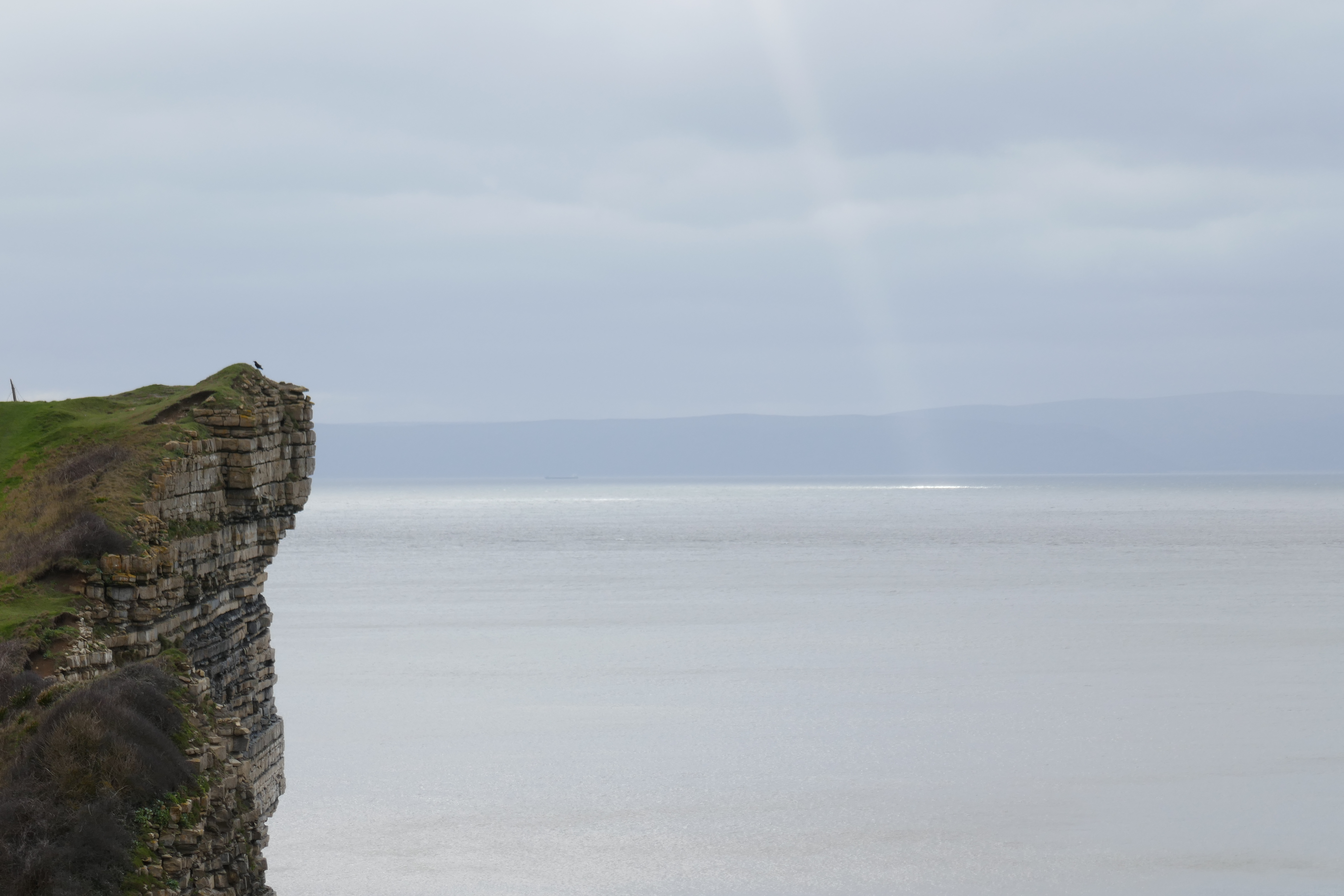
After returning to the stony beach at Llantwit Major, I climbed steps out of the narrow valley, admiring the cliffs on the other side. The path then faithfully followed the edge of the cliffs, close to my left. As they looked pretty unstable, with a few large cracks and landslips, I took care to keep away from their vertical drop. They are made of the Blue Lias, a distinctive rock formation of Jurassic age, composed of alternating layers of grey limestone and shale, the limestone bands around 20 centimetres thick and standing slightly proud, the shale layers a little thinner, slightly darker and more easily eroded. On the foreshore the limestone formed wave cut platforms, like pavements, the smooth grey rock cut by regular joints or cracks. Periodically the path dropped down into a steep sided valley, flanked by slopes covered with low trees and bushes, bare of leaves at this time of year, a few yellow gorse flowers relieving the drab winter colours. I always seem to walk this section in winter, the paths muddy and slippery, the sky overcast, although not without beauty as the sun sent shafts of light through gaps in the clouds. Today I was joined on the trail by dog walkers and elderly couples, all wrapped up against the cold wind.
Interest was added by a number of sites including a few pillboxes from the Second World War designed to defend Britain from invasion. St Donat's Castle was an older fortification, its crenelated battlements now home to Atlantic College where students from around the world study for their International Baccalaureate. Its buildings extend down to a stony beach, I looked in at an opening in the wall, but all was deserted. Dunraven Castle further down the coast is now in ruins, many of the remains are of a Victorian age when there was a romantic interest in Mediaeval structures, but its foundations were much older.
A lighthouse, brilliant white as if in a paint advert, breaks the skyline near the valley at Marcross, an older smaller lighthouse squats nearby. I remembered this section from walks with my parents as a young child, climbing the lighthouse on occasions it was open was particularly exciting, although nowadays, with GPS and ship borne radar, I wonder whether the lighthouse and the huge foghorn nearby has any utility. At the carpark beyond I was blessed with a building selling coffee and Welsh cakes (for the uninitiated the dough, speckled with currents is made into flat, round shapes and cooked on a gridle). Later, after the town of Ogmore I tried a "chimney" cake, which was new to me. A cylindrical tube was made by wrapping a coil of dough around a wooden form, which was then rotated as it cooked above a heating element, the lad at the stall selling them outside the closed "Pelican in its Piety" pub showed me how I could see it being cooked by looking at a specially positioned mirror above. More of a sweetened bread than a cake I had mine wrapped in chocolate powder (which made it a bit too sweet).
| Looking back at the cliffs of Blue Lias on what is known as the Glamorgan Heritage Coast. |
| Marcross Lighthouse and its older, squat colleague to the left |
At Ogmore the Coast Path misses the town (which seems to lack any centre), running through a car park set in a grass covered area cropped by sheep, above the beach distinguished by outcrops of grey Carboniferous limestone. A line of fishermen where casting off from rocks nearby. In their old age, my parents used to come to this car park, and sit watching the sea or reading their library books with sandwiches, a flask of coffee and maybe a hard boiled egg each with some salt and pepper in a twist of aluminium foil. After Ogmore the trail heads inland in order to cross the River Ogmore at a footbridge upstream. I have read that at low tide you can wade across the river close to its mouth, maybe near the sign saying "Danger - No Swimming", but I have never attempted it. A little way upriver are the ruins of Ogmore Castle, beside which are stepping stones for crossing. Today they were under the fast flowing water making the white footbridge further inland, a metal suspension bridge, the only option. All of the paths were muddy today (as they are most of the winter) and the field before the bridge was particularly water soaked and squidgy.
After crossing the River Ogmore and walking by the thatched cottages of the Merthyr Mawr village, I reached the sand dunes of the same name. Hidden among the trees by the entrance car park are the remains of Candelston Castle, a 14th century fortified manor house. After walking through the dunes and following the River Ogmore downstream to its estuary I reached the long beach stretching two or three kilometres towards the town of Porthcawl. Mainly sand with a band of pebbles separating the beach from the sand dunes behind, there was plenty of wood and flotsam washed up. Some kids huddled together at one end of the beach while dog were exercised on the sands. Blue-grey clouds covered most of the sky but the unseen setting sun sent shafts of warm light down to the sea's horizon and coloured sporadic patches of cloud an orange-brown.
As I circumnavigated a holiday park of trailers, their windows dark, and wandered through the town of Porthcawl, the twilight turned to a moonless night. Although I had brought some healthy food (tuna and couscous) for tea, I was tempted by the fish and chip shops. After resisting the attractions of the first three I succumbed at the fourth and enjoyed a generous helping of battered cod and chips in the dark of a shelter provided for visitors, out of the wind by the beach, my head torch proving essential. I then continued on the coast path, sharing the pavement with people out running and dog walkers. Beyond the old Miner's Rest Home, now turned into blocks of luxury apartments, the route follows a boardwalk between the beach and a golf course. A sign stated that the path was closed. Diversions are reported on the Wales Coast Path website, but although I checked I had not spotted this one, maybe it was new. While the notice described a diversion, I did not recognise the street names and it referred to "informal" paths, but gave no clue as to where they went. A map would have been really useful. Sometimes these notices are put up due to maintenance works. At this time of night no-one would be working and if some of the boardwalk was in pieces, I reasoned I could easily divert onto the beach (the tide was out). So having checked there were no river crossings on the route (where a footbridge might be out of action), I walked around the barrier and headed quickly down the path before anyone saw me, my head torch lighting the way. There was no sign of any maintenance activity, and the boardwalk was easy to follow. I have often found that diversion signs are posted for periods well beyond when any maintenance or tree felling works are in progress, I guess it makes it easier for the bureaucrats, who are not accountable for the difficulties they cause, if they were walkers they would surely have posted a map.
After the boardwalk section things were made difficult as I entered the sand dunes of Kenfig burrows, as areas of water reflected what little light came from the sky, appearing as steely grey, mirrored planes of irregular shape among the matt grey-black of the surrounding area. No lakes or ponds were marked on my map, and as the track disappeared into the water I realised they were regions of low lying ground flooded by recent rains. I worked my way around them on the raised area behind the beach but it was hard work in the dark. Time to stop for the night.
I picked a sheltered spot to camp up in a dune among the tussocky grass on apparently flat ground (although during the night I tended to move down the slight slope). During the long days of the Covid 19 lockdown I had bought a bivi bag on-line for no special purpose. I thought it might be useful should I need to camp in an emergency (although I would also need to carry a sleeping bag), or maybe I was just bored. So tonight I decided to try it out. It meant leaving my back pack and boots outside, which I was not entirely happy with. I put them in black plastic rubbish bags to protect them from any rain. Getting my boots off and trousers down, before climbing into my sleeping bag, all without stepping on the damp sand required a good deal of agility, but in time I was cosily tucked into my sleeping bag within my bivi bag, writing up my day by the light of my head torch.
Three landscapes today; attractive developments of old dockland areas; cliffs, stones, and sand along the sea shore, and walking on pavement beside busy roads.
Whereas, the previous day's walk went through some of the less attractive parts of Cardiff, industrial estates and wasteland, this morning I walked through areas that had been redeveloped. In the past the areas around the docks had been rough and industrial, my grandfather was a policemen in the area and received an award for breaking up a fight in one of the bars. Now, there are modern flats, trendy restaurants and restored old buildings. From Queen Street railway station I walked down to where a short length of old canal, topped by water lilies, meandered through modern, and no doubt expensive, houses and flats. This lead to an old dock, where a fisherman had set up his tent by a no fishing sign (due to dangerous blue green algae), a cormorant patiently waited on concrete pillar nearby . County Hall, the modern administrative offices for the area, was at the end of the dock. From there I crossed the road to the Wales Millennium Centre, where plays, pantomime, opera and musicals were performed in what now seem distant times before the Coronavirus pandemic. The metal covered frontage has the words in English "In these stones horizons sing", much of the building is faced with Welsh waste slate, slate being one of Wales' major products in the past (and still available today). Curiously the Welsh words on the frontage say something entirely different, in English they read "Truth is as clear as glass forged in the flames of inspiration", thoughtful if not always true.
Beyond the Millennium Centre is Cardiff Bay, once an estuary surrounded by world class docks, exporting coal around the world, it reached its peak around 1900, making Cardiff a major city. Now a barrage has made it a tide free area of leisure (it has is own circular walk, the Cardiff bay trail, if you care to follow it). Looking onto the bay is the Sennedd, the Welsh Parliament where assembly members control areas such as health and infrastructure. Glass fronted to indicate transparency, I peered in, little seems to happen inside. Next sight was the Norwegian church, many Norwegian sailors visited Cardiff in the past (along with many other nationalities), now (or at least in pre-Covid times) the church is an art centre and café. Beyond, I crossed the barrage itself, a sort of large dam or breakwater with a path and road (closed to public motor vehicles) on top, the smooth waters of the bay on one side and the tide out in the Bristol Channel on the other. Given the amount of water flowing from the former to the latter it is surprising there is no hydroelectric plant capturing the energy being lost in the water falling from the weir gates. A sign on the barrage alerted me to the existence of a "Wales Coast Path" App, available for download from the usual places. I downloaded it once I was home. It shows on a satellite map where the path goes and gives other useful information, including the location of a surprising number of shipwrecks, but I struggled to use it for any useful navigation, with its snail like update speeds.
After the barrage I climbed the road up the hill into the older backstreets of Penarth, leaving the modern marinas and apartments behind, then descended towards the Penarth shoreline. On the descent I diverted into a little park called the Kymin. Penarth, which flourished with tourists in Victorian times, has a stony beach (where once I collected alabaster and fossils), some cafés, a lifeboat station, benches on the seafront promenade, and a pier. In its heyday the pier had big shows with pop stars and the like, today it has a café and in better times hosts art displays. Sadly, although the pier was open, its café and gallery was closed due to the usual excuse, Covid 19. Other cafés were managing, although I had to use an App on my phone to order coffee and cake, then discovered I had only bought one of the cheaper cakes, not the one I was drooling over (probably better for me though)! Continuing uphill, I followed the Wales Coast path above the cliffs to Lavernock, at first by road, then on a tarmac path in a grass area in front of expensive houses, sharing the path with older folks and their dogs, and finally along a path between bushes. Lavernock was where the first radio signals transmitted over sea were received by Mr Marconi from Flat holm, an island in the channel. Today there is a caravan site, where I countered three signs saying "NO TENTS", so if you have a tent, you are NOT WELCOME. There are a number of caravan sites in this section of coast, mainly with permanent or static caravans or trailers, providing a holiday or holiday home for those living inland in South Wales. At one time there was a car park and a kiosk selling drinks where I listened to the World Cup final of 1966, but maybe the cliffs have eroded away since then, as now there is no sign of it.
From Lavernock the path took me through a nature reserve. Among the bushes and rough ground there were the concrete remains of World War Two defences against enemy aircraft and shipping coming up the channel. At Sully, in front of the Captain's wife (a pub serving food), is an island, reachable at low tide. A display told me how much time I had to cross to the island before high tide prevented my return. Deciding against a visit today, I continued along the pebbly coast until the Wales Coast path turned inland passing a field of black sheep. For the next few kilometres I walked beside roads full of traffic. There was a pavement, and periodic Wales Coast Path waymarks, but the road was busy and the walk tedious. Tall, distillation towers of a chemical works reminded me of the heavy industry that once characterised South Wales, but now the coal mines, most of the oil refineries, tin plate works and the like have gone, and the various steel works are just hanging on in the face of cheaper Chinese imports. Much of Barry's industrial past is now gone. Modern flats line the old docks and where once steam engines shunted loads, before being abandoned to enthusiasts, a housing estate is now being built. I stopped at a trendy looking expresso bar, a converted pump house, for some lunch. As a sign required of me I scanned a QR code with my phone, but was unable to order anything. It appears that was just for the "track and trace" system, designed so that I could be contacted if there was an outbreak of coronavirus in the café. I was told I would have to scan a second QR code to actually order something. One QR code can be justified, two was just poor service, so I left to cross the causeway to Barry Island. It is not really an island but it is so different to the rest of Barry that it deserves a separate name, for this is where my family used to go to sit on a Saturday on the sandy beach in deck chairs with my Grandma, a canvas wind shield protecting the adults while us children dug holes in the sand, or, if the family finances allowed, we would visit the fair ground for a ride on the "big dipper". Although Barry Island lost visitors to package holidays in Spain in the years since I was young, since it was made famous by "Gavin and Stacy", a TV Sitcom, and with an upgrade to the promenade, it has seen a resurgence in popularity. Today though, there were few visitors. As I crossed the causeway, the drizzle started. No rain had been forecast so initially I tried to ignore it. A mistake as drizzle turned to a shower turned to steady rain and my trousers were soon wet. I hid in a café for a while, less demanding of QR codes and Apps than the previous one, but it was still raining when I finished, so I continued on a circumnavigation of the island as indicated by the map and occasional waymarks. I deviated slightly from the Wales Coast Path to walk across Jackson Bay, a small quiet beach, a better route which included a stretch walking beside the limestone as its beds dipped into the sea. If you look at the cliffs at Jackson bay, and on the far side of the main beach, you can see where the horizontal, reddish Triassic rocks lie unconformably on the grey, dipping Carboniferous limestone. After the promenade, with its brightly painted beach huts and the small climbing wall, I walked around the final headland and retraced my steps across the causeway to Barry Railway station and a ride home to some dry clothes.
Laugharne and reaching Pembrokeshire were the highlights today. Not wishing to miss my train home today from Saundersfoot I left St Clears ...