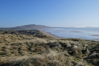
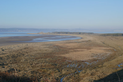
Today, beautiful long bays of sand, and some muddy cliff top sections.
The night seemed colder than the three degrees centigrade forecast. A thick coat of frost had covered by backpack when I woke for a call of nature in the early hours. Probably a mistake not to bring my warmer, but bulkier, sleeping bag. My reward for a night camping by the beach was a glorious, uplifting sunrise, the clear sky banded by pink and orange preceding the red orb of the sun rising above the sea, facing the setting moon, as it grew progressively fainter on the other side of the sky. After packing away my bivi and sleeping bag, both damp with condensation I walked along the edge of the sea as it reached high tide, leaving a small strip of sand in front of the dunes. Shells of many varieties were spread out before me among scraps of black washed up seaweed: clams, giant mussels, razorshells, gastropods and molluscs of various sorts. A flock of small, grey and white birds chased the water in and out before rising into the air on my approach. At the car park at the far end of the beach there were signs of life. Two surfboards lay beside a van with its boot up. Glancing inside as I quietly passed I saw a blanket spread out on the load bay, with signs of people moving beneath it. A nearby sign warned that overnight stays were prohibited, but a few people had ignored the instruction. However, they would have been unable to use the toilets as, in addition to a padlocked gate, a large drift of windblown sand prevented entry.
 |
| Shells on Oxwich beach |
I continued by St Illtyd's church, hidden among the trees, built in the 12th century on the site of a much earlier church. Low trees continued as I climbed up and down a steep hillside, thankful for a few steps in places. Greenery hid a few limestone cliffs. All was verdant with harts tongue and other ferns, ivy and the new green leaves of wild garlic and bluebells. The gnarled, bare branches of the trees were all the more evocative of some mystical landscape than when they are clothed with leaves. After the woods and rounding a headland a section of path crossed fields along a raised beach, an elevated area formed at a time of higher sea level between the rocky shore line and ancient cliffs, now largely clothed in green. Yellow gorse was flowering on the hillside as I approached Port Eynon Bay, the next extensive beach, spread out in front of a village and many static caravans. The receding tide revealed areas in which peat and the remains of ancient trees poked through the sand, a phenomena I have also seen elsewhere on the Gower, it reflects a time when the sea level was lower than today, and trees grew on land now covered by salt water. Despite appearances to the contrary the Smugglers Inn claimed to open, so I pushed through the closed doors, and called out at the kitchen entrance. I was rewarded with a cup of coffee and a Welsh cake for my "elevenses" from a cheery lady, which I enjoyed on a bench looking out to sea.
 |
| Coast path around the headland before Port Eynon Bay |
Much of the morning was through fields made muddy and rutted by cows, sheep and farm vehicles. Between Port Eynon and Rhosselli, the next village, the Coast Path follows the cliff tops. In some places the trail dropped down into dry valleys (called "slades" hereabouts) that cut into the cliffs, with the inevitable climb back up on the other side. Elsewhere the path moved inland to go around the head of these short features, avoiding a climb but not the mud. There were also several coves with sand exposed by low tides but otherwise rocky. Worms Head are a scenic group of a rocks forming small islands at high tide extending westwards from the end of the Gower peninsula. I stopped by the small coastguard station from where you can walk out to Worms Head at low tide, a sign indicated the times the route was possible. I decided against attempting it today and continued to Rhossili. I had hoped to find a takeaway open but although the car park was full of visitors, everything was closed, so I continued around the church (whose tower with its pitched roof is typical of others in the area) to a grassy area and ate the lunch I had brought with me, looking down on Rhossili bay. Rhossili beach has been voted one of the top ten beaches in Britain, and the expanse of sand is certainly notable for its extent, although I consider Oxwich just as good. Beneath me the remains of a shipwreck poked out of the sands.
 |
| Looking back at Rhossili Bay |
Following fields across another raised beach I arrived at the first of a number of caravan parks in the area. I crossed the dunes onto the beach where a number of people were enjoying the sunny Sunday weather: surfers, people with dogs, and families with children. At the far end of the beach, by another island created by the rising tide, the path rose up into the dunes, leading to Blue Pool bay, the next small beach with a famous deep rock pool; as it never looked that blue to me I did not climb down to visit today, although I did admire the natural arch on the other end of the bay. More remote than the nearby beaches only two people were sitting on the rocks today.
 |
| Looking down the peninsula of Whiteford Burrows |
I walked down into a second caravan park and onto the wide beach of Broughton Bay, where two horses were exercising. There were noticeably fewer people as the sun was dropping in the sky. At low tide you can walk around the next headland, but today I climbed over it passing a third caravan park. The area's beauty seems to attract many visitors! The path eventually dropped down onto Whiteford Burrows, a long peninsula of beach, sand dunes and pine trees that sticks out northwards at the end of the Gower peninsula. The outward route along the west side of the peninsula is ill defined but there were plenty of tracks among the marram grass in the dunes or you can walk along the beach. I did a little of both. Flocks of black and white birds were floating on the water near the beach, unfortunately I disturbed some of them and they rose to the air as a group, silhouetted by the setting sun. Sunset created bands of gold, then red then purple as the red circle of the sun sank into the sea in the clear but rapidly cooling skies. Before all the light disappeared I picked a sheltered depression in the dunes, close to the end of the peninsula to spread my bivi bag and slightly damp sleeping bag. There were signs around announcing "Danger" and "Perygl" (Welsh for danger), unexploded ordnance was about as the area was once a firing range. Fortunately there was none where I slipped into sleep, as the bright, white moon rose into the starry sky.
 |
| Birds at Whiteford Point, an old abandoned, cast iron lighthouse is in the distance and beyond that, on the other side of the water, lies Burry Port |


No comments:
Post a Comment