At 6:15 am I drifted into consciousness, pleasantly surprised that I was warm despite the air temperatures being close to zero degrees centigrade, some puddles being frozen on higher ground. Admittedly I had three layers of clothing on, including a down jacket, in addition to my winter sleeping bag. Another surprise was that the bottom of my sleeping bag was wet on the outside. Having checked I had not camped on a wet patch and that my water bottle had not leaked I concluded that it was condensation. This was the first time I had slept in a bivi bag, and various sources had warned that condensation could be an issue. There was none at the top of my sleeping bag possibly because I kept the top of the bag open to see patches of stars between the clouds. In fact the fresh breeze pushed the top of the bivi bag over my head so I saw little of the night sky but it did mean I was well protected from the cold wind (an advantage of having my feet pointing upwind).
By 7:00 am, having eaten two flapjacks and brushed my teeth, I was on my way just as the dawn was painting patches of orange on the clouds. Crossing the last of the dunes by the transient lakes formed by the winter rain I reached the end of the Kenfig reserve. A sign told me I was briefly on the haul road used to transport stone for Port Talbot's harbour, now a sand coated track. I climbed a large dune in front of me, from the tire marks it was used by scrambling bikes, it was also the wrong route, the coast path ran along the east side of the hill, leading me into a wooded area with reed covered wetlands and fields. Clouds of steam sporadically spewed out of the Tata steel works ahead of me, catching the warm glow of the rising sun. Last night the clouds above the plant periodically turned red as gas was burnt off from some industrial process. The woodland path exited onto railway sidings where I crossed a number of tracks. On reaching the last of these I saw a train in the far distance, I stepped back, fortunate as the train, travelling at high speed, passed me a few moments later. This was the main line from Swansea to Cardiff and beyond. On the other side of the crossing point there were many bouquets of plastic flowers (and one gnome), no doubt commemorating someone who died at this crossing.
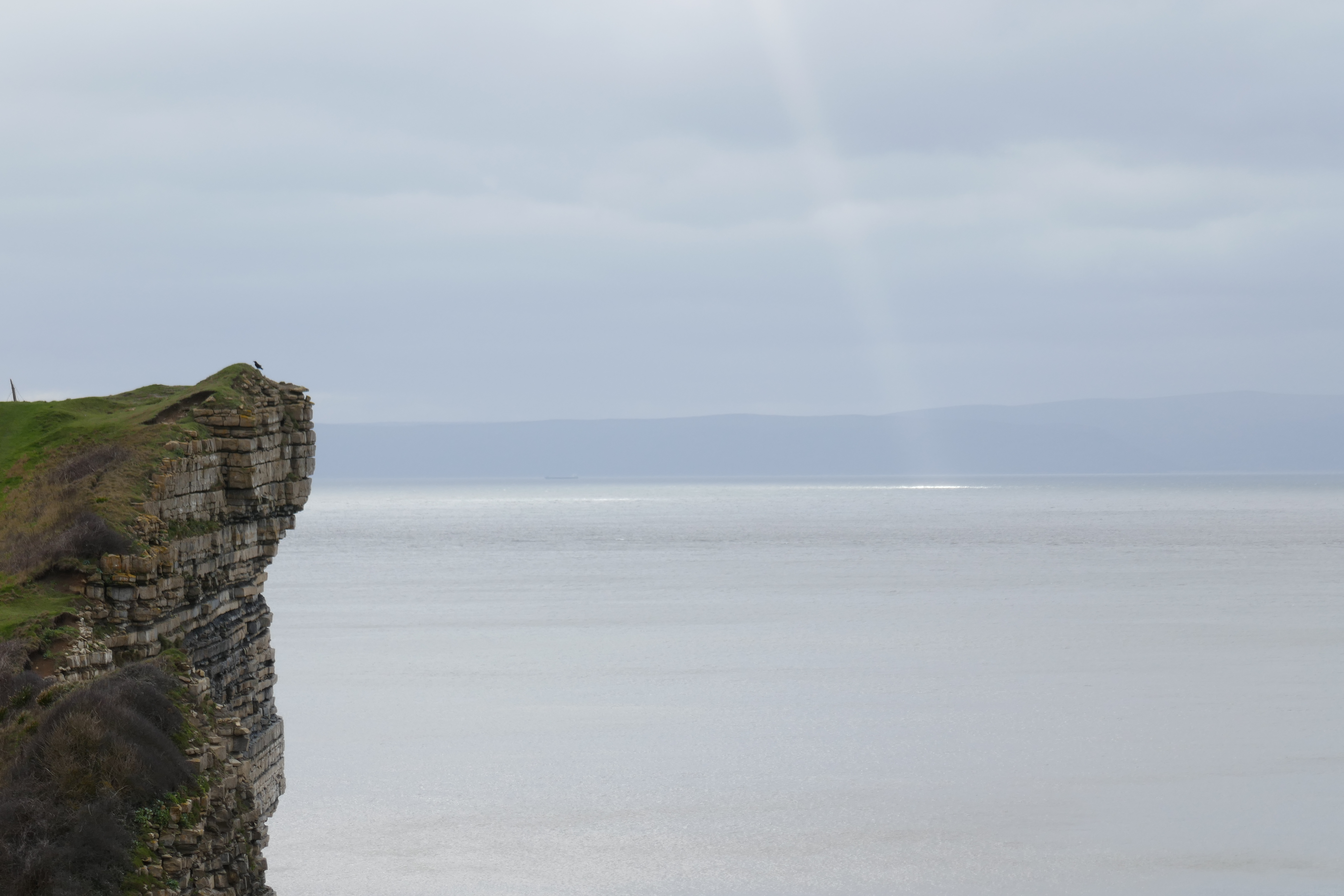
 |
| Kenfig Burrows in early morning light |
 |
| Tata Steel Works |
A little later, after the BOC works, I reached a large roundabout above the M4 motorway. Here the Wales Coast Path has two alternatives, I could either choose the lowland, blue route, which goes through urban streets, or climb up to the ridge behind Port Talbot on the upland, red route. The latter seemed the more interesting path to me, but it began with a steep climb up wooded hillside to a ruined chapel which I admired while wondering why it was built here. More uphill followed. My reward for my exertions was an excellent view from the ridge top of the Port Talbot steel works laid out beneath me. In my youth we drove by this industrial area to reach the beaches of the Gower peninsula. This was before the motorway was built and a busy railway crossing meant the journey through town was always very slow. Sulphurous fumes used to fill the air making the wait in a queue of traffic most unpleasant. With greater concern for pollution, the smells have long since gone and the air today was sweet as in any other town.
 |
| World War Two radar installation. |
On my ridge walk there were remains of World War Two structures, including a building that was once a radar station to detect enemy aircraft flying up the Bristol channel. As late as 2020, an unexploded bomb from the conflict was found in the steel works. The path dropped down from the ridge by some houses where I grievously upset the owner of Brombil farm. As the coast path sign was pointing up his driveway I followed it despite the "Private Property" sign. I clearly annoyed the owner who told me the path was a little after his drive and questioned my ability to read. I said sorry and headed off passed the "No Loitering, No Filming, No Camping" etc. signs. My impression was that the farmer might have had a few issues with ramblers. The path continued around the ("Private Property") hillside, eventually reaching houses and a valley, followed by another section of wooded hillside. This ended in more houses where the trail went under a length of motorway built on concrete stilts. A sign, which had possibly been twisted, led me on a small diversion off the coast path but I soon regained it at a roundabout by a large Tesco supermarket. Feeling it was time for a coffee, I diverted into the Aberafan shopping centre for a cup and a cheese toastie.
At this point I could have continued on the Blue route. It follows the promenade beside the long stretch of Aberavon beach ending in the sands of Baglan Burrows. Despite the nearby industry it is an attractive sea side route, but as I had walked it before I decided to see what the upland Red route to Briton Ferry could offer. A strenuous climb up lengthy flights of crude steps was the answer. I passed a man coming down who said he was climbing them four times for "training". I was struggling to mange it once, needing frequent stops which I justified by taking photographs back down into the lines of houses below the wooded slopes. Once at the top the inevitable descent began eventually leading to a suburban area before more woodland walking. A sign was missing a little before a dog kennels and I added a few hundred metres to my day before I realised and retraced my steps.
 |
| Climb out of Port Talbot on lengthy flights of steps |
 |
| Canal towards Swansea |
I crossed the wide River Neath high in the air on a road bridge and a prolonged section of walking beside a busy road followed, before the coast path led me to the quieter delights of an abandoned canal. Although the sound of vehicles and trains could still be heard I was surrounded by trees, reeds and lengths of weed filled water on this last length of muddy trail into the outskirts of Swansea. The city has seen much new building in recent years, new apartments and modern offices lined my way, and new tower blocks were in the throws of being constructed. Old docks were being beautified and industrial buildings removed or boutiqified as trendy restaurants and shops. However I had little time to browse as I had a train to catch, which I boarded with just minutes to spare, before it whisked me in a matter of minutes over the distance I had spent the last two days walking.


